Immerse yourself in memory of your past during a time you were outdoors with family or friends. Having fun playing a sport such as a football or a soccer match with the sun shining on your skin. After a little time passes, your sunny day becomes an overcast of darker clouds. You go to take out your phone to see that the weather forecast for the day has suddenly changed and none of you were aware. You decide to enjoy the outdoors a little more thinking that it will just pass by, but before you know it, a thunderstorm has approached and you are trapped in the torrential downpour. The meteorologist was wrong once again with their prediction. In fact, you probably feel like you could do a better job than they did. Well, decades later and with a new weather consultant technology available, you can now know and plan activities with accuracy.
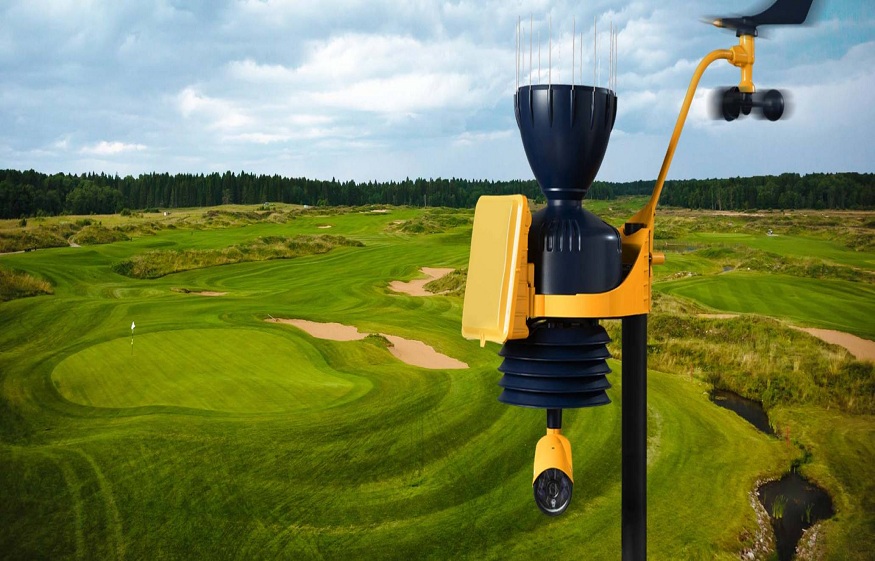
The Pocket Perry is a cloud-based mobile app that provides live and real-time weather information. It provides lightning alerts whenever storms are near and are accessible from anywhere. It’s like having a weather station in the palm of your hand.
Another specialized feature for Pocket Perry can help revolutionize the play of outdoor sporting events such as Major League Baseball, Track, and Field events and more. The outdoor warning system is also completely wireless and cloud-based. It provides real-time weather risk and lightening monitoring with no false alarms or maintenance required. A benefitting feature this particular device has is the ability to broadcast text-to-speech messages making you the weather consultant.
The type of radar technology used in the Pocket Perry won’t only save your day or athletes during events, but it could possibly save hundreds or maybe even thousands of lives. With climate change occurring, the possibility of unpredictable severe weather increases. Hurricanes begin to get stronger in the tropics year after year with their course being all but 100% predictable. Severe Thunderstorms passing through cities in the midwest of the United States before leaving powerful tornadoes to tear through homes and buildings. Researchers and engineers have been working to improve these types of situations from occurring in the worst possible way. True that it is pretty impossible to stop a hurricane or tornado from happening, but with longer warning times and the ability to gain more precise attributes as a storm intensifies, the information can help another plan according to or take shelter.
A key factor in doing this is improving the functions of radar since it is their primary tool of detection. Weather radar works by sending radio waves through the atmosphere. These waves then reflect off atmospheric particles such as ice or raindrops and return to the radar. Based on the measured strength of the waves and how long the return trip takes, a meteorologist can see and predict the location and intensity of a storm. The current technology is advanced to the point where storm speed and wind rotation can be measured and seen to predict and warn local cities and surrounding areas.
Another more recent upgrade to the doppler radar is dual-polarization, which allows forecasters to better see the difference between the type of precipitation and the amount expected to be received. Whether it’s outdoor sporting events, family-friendly activities, traveling or just knowing what is going on with your local weather. All of this new and upgraded technology goes into discovering and learning more about the atmospheric world around, in order to keep towns, cities, states and the world a little safer in terms of weather awareness and climate prediction.